
Whidbey Island’s very own snowstorm struck Wednesday afternoon and overnight, dumping various amounts of white stuff onto local communities.
“It developed over the island, and pretty much dissipated in place,” Carl Cerniglia, meteorologist with the National Weather Service in Seattle, said Thursday.
Some areas of the island were hit hard, others escaped with a dusting, Cerniglia said.
Up to six inches of snow were reported in Langley and four inches south of Green Bank, with only a dusting of flakes in Clinton and Scatchet Head and two inches in Freeland, he said.
But as much as nine inches were reported west of Oak Harbor, and seven inches in parts of Camano Island, Cerniglia said.
Where snowfall was heaviest, it mounted rapidly.
Four inches accumulated in the Langley area with two hours, beginning shortly before 4 p.m. City hall and Langley Library closed early, along with some shops, as residents and visitors hurried home. Wednesday’s meeting of the South Whidbey School Board was also canceled.
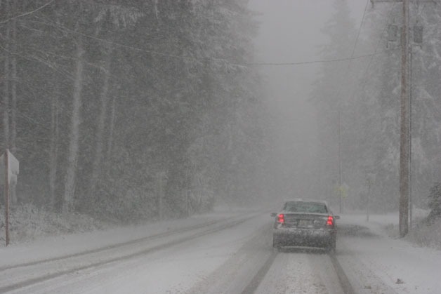
Meanwhile, temperatures dropped into the teens and low 20s overnight, creating slick roadways for motorists. Highway 525 remained passable, although the going was dicey on side roads in South Whidbey.
Drivers apparently were prepared for the storm, however; no traffic mishaps were reported Wednesday night, or by 10 a.m. Thursday morning.
“It was really quiet,” Island County Fire District 3 Deputy Chief Jon Beck said Thursday. “We were fortunate.”
Beck said the only incident other than routine medical calls was a tree that fell across Coles Road outside Langley.
Classes were held Thursday despite the snow in the South Whidbey School District, although schools started late.
Cerniglia said the forecast is for continued cold temperatures through Saturday afternoon, but with only a small amount of additional snowfall. Clouds are expected to increase by Saturday evening, however, with a possibility of more light snow next week, he said.

