
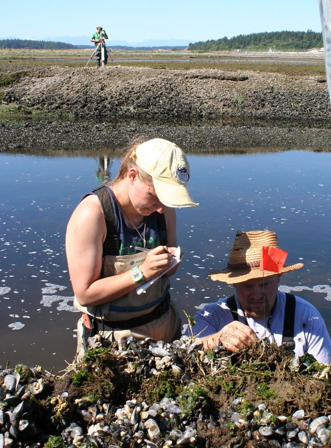
Frances Griswold excitedly pulled out a rock that crumbled in her hand and showed it to the other researchers Tuesday.
The Central Washington University graduate student worked with fellow student Brian Ostrom to painstakingly examine the layers of soil, mud and sand viewable on the bank of an eroded creek on the Seaplane Base just north of Crescent Harbor this week.
The university researchers, working under the supervision of professor Brea McGinnis, joined with local volunteers and the island’s emergency management organizations for the research all of last week. The purpose: piecing together Whidbey Island’s history of tsunamis, earthquakes and other geological events. Spearheaded by Island County’s department of emergency management, the study’s aim is to educate the island on what to expect and how to be prepared.
The research continues until July 17.
The decomposed rock discovered by Griswold is an example of a rock that aged in place, literally falling apart according to the makeup of its elements, McGinnis said.
Its age, however, is tough to determine.
“Its age depends on the layering process,” McGinnis said. “It was caused either by a lot of weathering or a lot of time.”
Each piece of information discovered, however insignificant, will help researchers map out the area’s history.
While in some cases the researchers are finding what they expected, conclusions can’t be made until the samples are examined and dated in a lab, according to Jim Rich, volunteer with Island County’s department of emergency management.
“Our goal right now is to look for evidence of tsunamis,” said Rich, a retired oceanographer. “With that data we can look at known events and try to draw some correlations.”
Among the known events is the three-foot ground shift discovered at Rocky Point on Whidbey’s eastern coast by previous academics. Rich said a shift of that magnitude would have an impact on other parts of the island and they are seeking evidence of that in Dugwalla Bay.
“We know for sure it happened at some point in the past,” Rich said. “It’s too big of an event not to be noticed.”
In addition, historical tsunamis triggered by South Whidbey’s three fault lines would dead end right into Crescent Harbor, Rich said. The two locations are the focus of this round of research.
McGinnis, who specializes in this type of research, said what the researchers see at Crescent Harbor is consistent with locations throughout Puget Sound.
What is unique about the area is its history of agriculture. The original harbor coast was farther west prior to the late 1800s when the area was diked and flushed with fresh water for agricultural use, according to the state Department of Ecology.
It remained that way until 1994 when a portion of the salt marsh was restored and native plants and animals reintroduced.
The various layers of marine organic material, driftwood, agricultural soil, trees, mud and sand make for an interesting and complex story, McGinnis said.
Within this, researchers are looking for layers of marine material, sand and peat that could have been placed there by tsunami waters. In addition, sand liquefaction — when pressured sand and water burst from the earth’s surface — is common around Puget Sound and is an indicator of earthquakes.
McGinnis said she’s seen evidence that the entire area around Crescent Bay was lowered significantly at some point during a ground shift of some sort.
To assist them in filling in the blanks of the last few hundred years, Rich has requested that Tom and Jan Ellis begin to compile information from the written and oral histories of the Native American tribes who first resided here.
Tom Ellis said while he has just begun his research, he has found that many of the oral histories are told in allegory or in “fanciful” terms, which may make recovering the information a challenge.
A call to a Swinomish historian was not returned by deadline.
From a public safety perspective, this information can be invaluable, according to Gary Jandzinski, emergency management officer for Whidbey Island Naval Air Station.
Knowing the way the earth and water responds to the shift of small local faults is critical for first responders.
“From an emergency management standpoint, we know the shallow faults are more dramatic… they cause a 20-to-30-second quake right under our feet, causing potentially a great deal of damage depending on the size and type of a building’s structure,” Jandzinski said.
“It comes down to, the more we know, the better.”

