
By SUE ELLEN WHITE
Special to The Record
In the August Monday morning sun, by foot, motorcycle and car, commuters board the Clinton ferry headed for the office, plant or meetings.
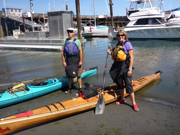
Below on the beach, we’re getting ready to head north to Cornet Bay — 45 miles by kayak.
The last of three separate legs in our journey to circumnavigate Whidbey, we’ve planned for three days. With clear and warm weather forecast and our route up the more protected east side of the island, my husband John and I are feeling confident and relaxed.
Not far from our launch at Clinton Beach Park we paddle past Brighton Beach where a sky-blue house lies akimbo, a log sticking up from its fractured parts. It is posted with signs warning people away from one of Whidbey’s more spectacular bluff failures.
The jarring sight contrasts with a heron resting on a pier, waiting for the tide to go out, and with two deer who meander the beach licking rocks for the salt.
At Marissa Lane, just south of Langley, we pause to see if we can locate the new sign notifying boaters of its public access. A large “No Trespassing” sign so commonplace on our shorelines is visible on a nearby bulkhead, but not the one telling us where we can legally get to shore. The tide is going out so we paddle close to get out and look, but the tidelands are apparently home to ghost shrimp. The two-inch crustaceans attract the mammoth gray whales to the area each spring. These whale treats make the beach soft. As we get out, we start sinking and abandon the idea of locating the sign.
Just south of Langley, the water is rich with a meadow of bright green eelgrass shimmering in the sun. It’s home for crabs, small fishes and many other sea dwellers, the sign of a healthy environment.
Langley’s harbor entrance is well marked and we watch the flow of crabbers, pleasure boaters, kayakers, visitors and paddle boarders at the marina. Our stop is brief as we’d need to hike up the hill to get to town; there is no secure place to leave our boats and no place to camp.
To the east, Hat Island and Camano Head form a backdrop for the rugged volcanic Mount Baker, known as Koma Kulshan to the Salish people. The mountain will be our constant companion on the trip. We turn northwest, following the shoreline. Wooded hills and small green fields mark numerous small hobby farms. The bluffs and beaches here seem the least disturbed and most stable of any we’ve seen on our circumnavigation.
Between Bell’s Beach and Fox Spit the water is rich with egg-yolk jellyfish. Aptly named, these cold-water creatures have little sting, feeding on smaller jellyfish and zooplankton. They glide past our boats and it’s as though we are adrift in an enormous frying pan full of poached eggs.
Beach houses line the curve of the low sand spit at Fox Spit. Unlike some other coastline communities, the beach appears to be natural rather than human-altered, such as with high-pressure hydraulic hoses. In the mid-1900s it was common practice on Whidbey to build a bulkhead beyond the edge of a beach, then go offshore, stick a big hose in the water and aim it at the bluff. The bank sluiced down, filling the bulkhead and creating more land. This new shore was then platted, registered with the county and sold as beach lots. Such lots are now the objects of slides resulting from natural processes, exacerbated by such development.
The tiny islet off the east entrance to Holmes Harbor is lined with seals basking on the warm sand. Formerly known as Hackney Island, Baby Island is disappearing, a victim of the ceaseless energy of waves.
Shell middens provide evidence of long use by the Salish people who used the abundant clams, mussels and other shellfish found there. After World War I the island was settled, then bought by wounded veteran Darrell Scott, according to a 1959 Seattle Times article. Scott set up a fishing lodge, selling bait and renting boats and rooms to fishermen. He also was witness to skirmishes between the Coast Guard and rumrunners during Prohibition. One winter was so cold that Holmes Harbor was locked in a sheet of ice and he rescued bootleggers whose boat had been trapped in the frozen water, according to The Seattle Times. Several days later, a generous sample of their wares, according to the article, appeared on his beach. The island has since returned to the ownership of the Tulalip Tribes.
With no camping facilities, we skip Holmes Harbor and Freeland and instead head north to our destination for the night across Saratoga Passage. Camano Island State Park’s water trails campsite is a welcome sight after a long paddle and we settle in right at the edge of the beach’s day-use area.
As with most camping, even the most basic meal tastes great. The day-use area closed and we enjoy our dinner accompanied only by a flock of small seagulls swooping after bugs just offshore. A long summer sunset illuminates Whidbey Island to the west.
Great blue herons and a pileated woodpecker are our morning companions till we cross Saratoga Passage again, meeting up with fellow paddler Baz Stevens, who accompanies us for the morning. A very accomplished whitewater and sea kayaker, he cheerfully resigns himself to our slower pace dictated by fully loaded boats and long-distance pace as well as the winds and current, which are against us.
We pass a large dock and sign reading “Whido-Isle Resort.” Now a residential development, the sign pays tribute to one of the long-gone small fishing resorts that dotted the area. Run by Trevor and Harriette Roberts, they raised their family by welcoming other families to small cabins and renting boats, clam rakes and buckets, creating indelible memories. Cama Beach State Park has preserved this charming part of our history where visitors can stay in tiny beachside fishing cabins.
With the tide out, Harrington Lagoon beckons as a rest stop. The wide, sun-swept beach is laden with clams and, surprisingly, oysters. We meet Robert the oyster farmer, a compact man with sandy beard, firm handshake and an infectious smile. It’s a mystery how he accessed the beach from his high bluff side aerie. He shows us his small oyster operation, noting that he also raises manila clams.
Today we are headed for Oak Harbor, the next available campsite, so we skip Penn Cove and Coupeville, catching a view of the graceful sailing ship “Suva” tacking across the harbor as we bid goodbye to Baz.
Another mass of egg-yolk jellyfish is just off City Beach, our campsite for the night. Some may scoff at camping in downtown Oak Harbor, but the city has provided a water trails site right on the beach with a magnificent view down Saratoga Passage. 
We do our best to reward their foresight by contributing to the local economy via a great dinner at an outdoor bistro. Evening at our camp is quiet, filled with twinkling green and red offshore navigation lights. In the morning, it’s a short walk from our tent to lattes and croissants.
Crossing Crescent Harbor, a noisy flock of seagulls is a contrast to the silent bobbing of numerous diving ducks. The shoreline is quiet and undeveloped, the result of long ownership by the U.S. Navy. This time, in the event of training flights, I’ve tucked earplugs in my day bag as protection against jet noise.
We paddle east. Across the water beyond Polnell Point, hills stack up in the distance. In shades of blue and purple they meet the sky punctuated by the rugged North Cascades. Mount Baker and Mount Rainier frame the north and south — this is arguably one of the island’s most beautiful spots.
With the tide out, we are drawn for lunch to the public part of a beach dominated by a massive glacial erratic, a rock left by receding glaciers thousands of years ago. It has a small sign stuck to it. Thinking it might contain interesting information, we approach: “No Trespassing,” it says.
Rounding Strawberry Point, we head northeast and the water turns milky green in Skagit Bay. The emptying of the Skagit River has been dumping river-borne material and nutrients here for eons, making the bay shallow and muddy.
It is only here that the tides begin to move through Deception Pass, rather than flowing all the way down Saratoga Passage, around Possession Point, back north up Admiralty Inlet and out the Strait of Juan de Fuca to the Pacific Ocean.
Our last campsite is our favorite on Whidbey, Skagit Island. It’s a small islet that fills with a succession of wildflowers in the spring and has an expansive view and remote feel. It is already occupied by two consummate outdoorsmen who’ve arrived via canoe and await more friends. Ron and Ray are quintessential Northwesterners and we share some adventures and the titles of our favorite books on the region.
The day dawns clear and fresh; our last short paddle takes us past Kikit Island, a tombolo attached to the mainland. At the tip is an added tombolo, and in the spring it is covered with delicate blue-flowered camas plants — one of the First Nation’s traditional staples, a starchy tuber.
At the end of the 1960s, this little gem at the intersection of Skagit and Simlik bays was proposed as the site of a nuclear power plant. Fortunately, the environmentally concerned prevailed and the land is now co-owned by Washington State Parks and the Swinomish Tribe.
By mid-morning we see the filigreed Deception Pass Bridge to the west as we end our trip with a high-five where we began it last summer, at Cornet Bay. We haul our gear off the beach and consolidate it at a picnic table just as a school bus arrives, full of young children from an Oak Harbor summer program. They are heading out to the pass with Deception Pass Tours.
For us this trip has come to a close, but these youngsters are off on their own voyage of discovery, likely seeing their home in a whole new way. For some, perhaps, it will be the beginning of a lifelong infatuation with the Salish Sea.
