
A sucker-punch snowstorm smacked South Whidbey Tuesday, the day before a storm of historic proportions was expected to wallop the Puget Sound area.
As much as six inches of snow fell Tuesday, which made the weekend’s smattering of snow seem like a love tap.
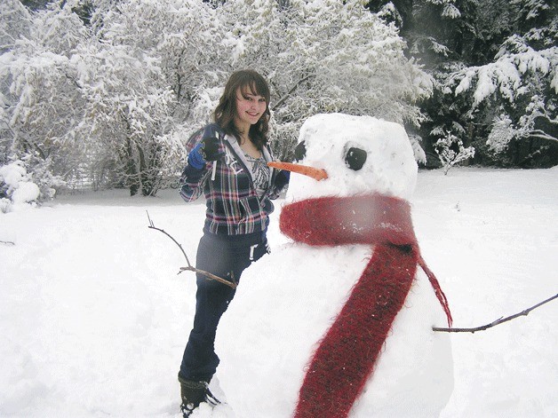
The wicked winter weather treated local school children with kid gloves, however, as youngsters enjoyed an unexpected extension to their three-day, Martin Luther King Jr. holiday weekend.
The snow piled up quickly Tuesday morning, and officials in the South Whidbey School District canceled classes and extra-curricular activities. Businesses on the South End shut down early, and government meetings — including Tuesday’s Langley City Council meeting — were called off. Langley City Hall was also shut down early, and employees were sent home.
The snowstorm hit Central Whidbey the hardest. More than 6 inches of snow was reported in Coupeville by noon Jan. 17.
Greenbank had nearly as much, while Freeland had 3 inches near the library. More than 5 inches of snow was reported in downtown Langley, while Scatchet Head got 5 inches. Roughly 4 inches of snow was reported in Clinton before noon Tuesday.
By about 10 a.m. Tuesday, when the storm began to hit the hardest, Island Transit canceled service on all its routes after trying to make do through the morning by having drivers avoid the steepest hills on Whidbey.
The snowy sneak attack spurred an early spike in snow shovel sales at Freeland Ace Hardware.
Even so, store manager Kari Gerow said there were a couple dozen left Tuesday morning.
“All morning the shovels have been going out of here like crazy,” Gerow said.
“We’re doing pretty well,” she said. “We’ve got 20 or so shovels. We stocked up.”
“What we don’t have are sleds. We ran out of sleds,” Gerow added.
South Whidbey residents were prepared, she said. There wasn’t a run on shovels or ice/snow melting salt as there was in previous snowstorms. And Ace Hardware still had a pallet of the salt buckets in the store.
“I think people have been proactive this time.”
“We’ve got plenty of faucet covers and batteries,” she added. “Tomorrow will be tell-tale.”
Tuesday’s storm should serve as a preliminary bout for Wednesday’s weather, when the real roundhouse is expected to hit Western Washington.
Forecasters had warned of a major snowstorm Wednesday earlier this week, and the National Weather Service office in Seattle issued a “winter storm watch” for Wednesday that will stretch into the evening. The storm is expected to batter Whidbey Island, the Admiralty Inlet area and much of the Puget Sound lowlands.
Johnny Burg, spokesman for the National Weather Service office in Seattle, said South Whidbey is expected to see between 4 and 8 inches of snow Wednesday.
The major winter storm was expected to hit after midnight, in the early hours Wednesday morning.
“As you go further south you’re going to see a little more,” Burg said.
Tuesday’s snow tested the patience of drivers on Whidbey. Traffic slowed to a crawl on Highway 525 and Highway 20 before roads were better cleared at midday, and emergency crews were called to assist multiple drivers who lost control on snowy roadways.
South Whidbey Assistant Fire Chief Paul Busch said there were no snow-related injuries reported.
Responders cleared a tree from the road on Brooks Hill at about noon.
“This stuff will turn to ice tonight, so that will be a different story tomorrow,” Busch said.
More snow in the days to come may lead to a longer school year for students.
![]()
Superintendent Jo Moccia said the school district has one built-in snow day on Friday, Feb. 17. It precedes the three-day President’s Day weekend, when other school districts take a mid-winter break.
Additional class cancellations and makeup days later in the year, however, could extend the school year into late June.
Tuesday’s storm marked Round 2 in a winter season that saw its first significant snowfall on Saturday.
Snow and ice-covered roads kept South Whidbey Fire/EMS busy over the weekend. Emergency crews responded to a half-dozen car accidents over the weekend, including a rollover crash in Scatchet Head.
“None of them were serious enough where anybody was transported to the hospital,” Busch said.
Most of the car accidents were not collisions, as drivers slid off the road and into ditches thanks to slick conditions.
Busch said the Freeland area, where the department’s offices are, was mostly clear and the majority of the snow problems were in Clinton and Scatchet Head, including a rollover near Swede Hill Road and Mortland Drive.
“The people walked away from that one,” Busch said.
Several inches of snow fell in the Clinton area overnight Saturday, with an additional dusting on Sunday. Most roads were cleared, and the state Department of Transportation had snow plows working on Highway 525 Sunday to keep pace with the weather.
Temperatures well below freezing caused a waterline to rupture Sunday at a house on Bayview Road. The road was closed and Busch called in a sanding truck, as water from the line quickly froze on the street.
“There was about a 50-foot stretch that was an ice skating rink,” Busch said.

